|
|
 |
OPEN ALL YEAR - LOCATED 2 MILES FROM BENNETT SPRING STATE PARK
1770 Highway 64 • Lebanon, Missouri 65536 • 417-532-3724
On Missouri's Beautiful Niangua River
 The
following Niangua River information is provided courtesy of Marc W.
McCord (Southwest
Paddler)
The Niangua River
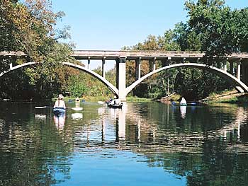
Forming near Marshfield, in Webster County of southcentral Missouri, is the very beautiful and very popular Niangua River, a stream of about 140 miles in total length of which nearly 114 miles are accessible for paddling. The name has many derivatives, but is rooted in the language of the Osage Nation, to which it meant "many springs", and was in reference to the springs all along the river that fed it then, and that feed it now. For the record, the Osage actually called the river Ne-hem-gar, meaning "bear", because black bears were prolific in the area at that time.
 The Niangua River is
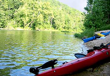
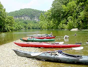
a gorgeous, flatwater stream that flows from south to north by
northeast until it empties into the Osage Arm of Lake of the Ozarks,
from which its waters flow to the Missouri River as the Osage River.
Most surrounding land is undeveloped and very natural, with Bennett
Springs State Park located about 48 miles below the first practical
access near Charity in Dallas County. The river is a popular fishing
stream for rainbow and brown trout, bass, catfish and many other
species. It is surrounded by state-managed conservation areas where
hunters can pursue deer, wild turkeys, squirrels, rabbits, waterfowl
and other edible creatures. Paddlers can enjoy 113.8 miles of
accessible waters with many convenient places to enter or leave the
river, and most of it is far removed from civilization, though some
sections are inundated with liveries and outfitters befitting the
Colorado River in Colorado, the Buffalo River in Arkansas, the Illinois
River in Oklahoma or the Lower Guadalupe River in Texas.
 The Missouri
Department of Conservation (MDC) has created numerous excellent access
points all along the river for the benefit of recreational users.
Between MDC Charity Access on Highway M, 3 miles west of SH 38 in
Dallas County, to MDC Big John Access on SH 32, about 1.2 miles east of
Buffalo, the river flows at navigable levels from late-spring through
mid-fall, unless early-spring rains provide additional water. This
reach of about 20.3 miles offers intermediate access points at 8.1 and
19.0 miles, making it convenient for paddlers on a reach that is not
quite as popular as some of those below. The Niangua is a little more
remote in the sense that it does not have outfitters everywhere you
look. Camping is not alalowed at the top or bottom of this reach, but
paddlers may use riverbanks at the intermediate access points for
overnight stopovers. This beautiful section of the river will normally
have a lot less traffic, and paddlers can enjoy the solitude of a quiet
river surrounded by a natural and largely undisturbed wilderness.
 Location
Southcentral Missouri, flowing from Charity to Buffalo in Dallas County, just east of Lebanon and northeast of Springfield, about 40 miles away (as the car drives - crows can knock off about 10 miles.)
Distance from Major Cities
St. Louis 177 miles; Joplin 112 miles; Springfield 40 miles; Kansas City 150 miles; Oklahoma City 318 miles; Little Rock 375 miles; Dallas 533 miles; Austin 723 miles; San Antonio 803 miles; Houston 789 miles; Albuquerque 870 miles; Phoenix 1,310 miles; Denver 953 miles; Salt Lake City 1,429 miles (all distances are approximate and depend upon starting point, destination point to your put-in on the river and route taken.)
Water Quality and Flow
Water quality is usually very good to excellent most of the time flowing from springs that feed the river and runoff from local rainfall. Navigable levels usually occur from mid-spring through late-fall.
 Hazards to Navigation
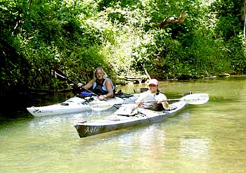
There are no serious hazards to navigation located along this reach of the Niangua River. Its shallow gradient and modest current provide an easy paddle that almost any boater can enjoy.
River Access Points
MDC Charity Access on Highway M, 3 miles west of SH 38 in Dallas County, at 0.0 miles; Dallas County Road 203, about 5 miles east of Highway H, at 8.1 miles; SH 32 bridge, about 4 miles east of Buffalo, at about 19.0 miles; and MDC Big John Access on SH 32, about 1.2 miles east of Buffalo, at about 20.3 miles.
Comments
I like this section of the Niangua River because it tends to be "the road less traveled" by most recreational paddlers. What it lacks in year-round flow conditions is more than offset by its immense natural beauty and the serenity of paddling a quiet, flatwater river, though I will admit a love of whitewater rivers whenever I can find one! Conveniences are not as good on this section as below, but the river offers an excellent paddling opportunity in spring and summer months, extending into early-fall, with wildlife, birds and many species of fish all around. It is an excellent place for wildlife and nature photography, with easy access along the way. Hunting and fishing can be done nearby, so paddlers can combine other outdoors activities with boating for a total experience, and with the river navigable all the way to Lake of the Ozarks, multi-day trips are almost always possible. This is a gorgeous stream that will capture the heart of anybody who loves to paddle, and it is easy enough for novice paddlers to enjoy without too much trepidation about rapids, waterfalls and other hazards. Unfortunately, the only USGS gauge on the Niangua is located at Tnnel Dam near Mack's Creek and Lake of the Ozarks, many miles downstream, so a visual inspection is required to know the true nature of the river at any time. Be sure to pack your camera!
[ Home ] [ Pictures ] [ Camping Rates ] [ Niangua River ] [ Driving Map ] [ Fishing ] [ Base Camp ] [ Contact Us ]
Kayak Base Camp
/ Menagerie Campground
1770 Highway 64 • Lebanon, Missouri 65536 • 417-532-3724
![]()
